How to Use a Map and Compass
After packing fifty pounds worth of equipment, hauling it out to the trail, and dressing for a day of adventure, you realize that you never learned how to use a map.
It’s okay, no one really expects you to know how to use a map or compass anymore. With the introduction of GPS into our lives, many people can find this task very difficult to perform.
Before you head out on your next adventure you will want to plan your route in advance. The choice of terrain will play a big factor in the preparations you will need to make.
Keep reading to learn how to use a map so that you can find your way anywhere.
All About How to Use a Map
Consider the Terrain
By looking at the curved lines on a map you can see the topography of the area. You will need to pay particular attention to this. The choice of terrain will play a big factor in the preparations you will need to make.
Make sure you plot the trek that is right for you. Some terrain can be difficult to navigate for smaller children or those with medical conditions. Other trails are specifically designed to challenge those that consider themselves nature experts. Playing it safe can help you avoid dangerous situations.
Pay attention to the recommendations for the trails you select. Playing it safe can help you avoid dangerous situations.
Map Scale
Knowing about scale is the most important thing to know about how to use a map. On every map, typically in a corner, you will find a scale that correlates the distance in real life.
Mark Your Route
When you are traveling through an unfamiliar area it can be easy to get turned around. By marking significant sightings on your map as you go, you will have an easier time finding your way back.
The best terrain markers are found up high. This will help you avoid losing your bearings due to changing environmental conditions. Some good options can be signposts, large trees, and waterfalls.
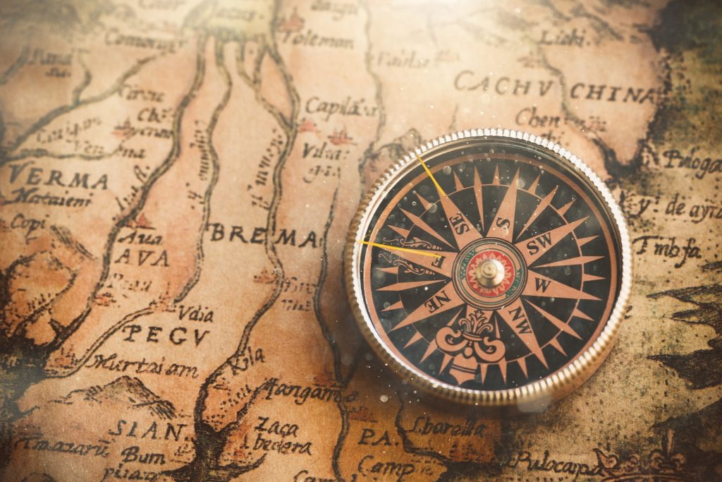
Orient Your Map
To use your compass together with your map you will need to go through the orientation process. To do this you rotate the map until its meridians are parallel with the compass needle.
Once your map is rotated the needle will be pointing north and you can then accurately calculate the next step to take. When you see something lying to the right on the map, it will correspond perfectly and be on your right in reality.
Keep Track of Terrain Objects
As you are following your chosen route you will want to check the terrain on the map for any obvious signs that you are going the right direction.
Noticing when you come across one of these objects can also be a great way to alert yourself that it is time to change direction.
When you run out of terrain objects there is another system that you can use to make sure you are staying on the right path.
The most simple way is by using the Silva 1 2 3 System:
- Place the compass on the map with the edge along the line that you want to travel.
- You will want to make sure that the arrow printed on your compass is pointing in the direction in which you would like to go.
- Rotate the bezel so that the N marking corresponds with the direction of north on the map.
- You need to check that the map meridians are parallel with the north/south lines.
- Stand with the compass held in front of you.
- Rotate your body until the needle is pointing toward N on the bezel.
- The arrow should now be pointing precisely in the direction in which you need to travel.
- Select a landmark on the horizon and begin your journey.
Gripping the Map
Many hikers find it helpful to hold their thumb on top of the map while they are following a route. They place it over their last known location to make it easier for them to calculate how far they have gone.
Knowing Your Distance
When you are using the Silva 1 2 3 System to navigate your trip you will need to be careful to properly mark the route you have taken along the way. Maintaining your bearing is the only way to ensure that you will have a successful journey back to camp.
If you pass objects on your journey you can mark them off as you go. But when you happen to be crossing open terrain you will need to use one of two other methods for judging distance.
The first method is time. By recording how long it takes for you to cross a certain area you can get a general idea of how far you went.
If you happen to be lacking a watch on your journey, the other method you can use is counting your steps. Although it isn’t as accurate since everyone’s steps vary, this system is certainly superior to nothing.
If you are unsure of how fast you walk it may be a good idea for you to time yourself prior to starting out on your hike.
Using a Mirrored Sighting Compass
Open terrain areas can make it difficult to orient yourself when traveling long distances. To combat that a mirrored sighting compass can be used.
When you are using this style of compass you will need to stand with the mirror folded into a forty-five-degree angle and pointing towards yourself.
This makes it easier to check if you are walking in the right direction so that you can keep your eye out for new landmarks to walk toward.
Always inform someone where you are going for your hike and when you plan to return in case you have an accident.
Learn More
Knowing how to read a compass is a great life skill to have. Now that you know how to use a map, you will be able to find your way home from anywhere.
If you would like to learn more helpful information on share-worthy topics, visit UpGifs for more articles.